


The Pan-African Paradigm of Cartographic Sovereignty and Historical Correction
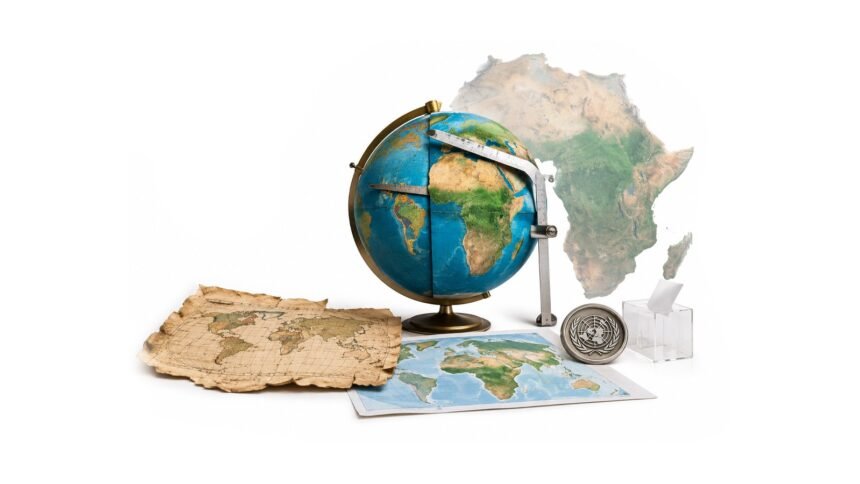
For nearly five hundred years, the world’s most widely reproduced map has quietly told a falsehood about Africa’s size, compressing a continent of over 30 million square kilometers until it appears roughly equivalent to Greenland, a landmass some fourteen times smaller. The Mercator projection, drafted in 1569 to aid maritime navigation, distorts landmasses in proportion to their distance from the equator—inflating Europe and North America while flattening continents nearer the equator, Africa foremost among them. This is not a neutral cartographic accident; it is one of the more durable artifacts of a colonial-era worldview in which African territory was rendered visually peripheral even as it was economically and politically central to the empires that drew the maps. The African Union’s campaign to displace Mercator in favor of a more accurate projection has moved, this week, from advocacy to formal international endorsement, with the United Nations General Assembly voting overwhelmingly to support a shift toward the Equal Earth projection. The resolution carries no binding legal force, and it explicitly preserves Mercator’s continued use in maritime and aerial navigation, where its properties remain genuinely useful. But its symbolic architecture is significant: a Togo-led initiative, built on years of AU advocacy, has now secured near-universal international recognition that the map through which billions of people have learned to picture the world has systematically diminished Africa’s true scale. Reclaiming an accurate cartographic self-image, one where Africa’s size on paper finally matches its size on the ground, is a small but structurally meaningful act of continental self-determination.
164 to 1: The Vote and Its Lone Dissenter
The resolution passed the UN General Assembly by a vote of 164 to 1, with six abstentions, a margin that underscores how uncontroversial the underlying cartographic correction has become even as its political framing proved divisive for at least one member state. The United States cast the sole vote against the measure, with its representatives arguing that the resolution promoted an “ideological agenda” and distracted from the “genuine problems of international peace, prosperity or good relations.” That framing, treating a map correction as ideological overreach rather than technical accuracy, illustrates precisely the kind of institutional resistance that has allowed the Mercator distortion to persist unchallenged in classrooms worldwide for generations, despite cartographers having understood its equatorial bias for decades.
Togo’s Foreign Minister and the Architecture of the Campaign
Togo’s Foreign Minister Robert Dussey, who led the initiative through the General Assembly, framed the vote in terms that extended well beyond geography. “A fair world begins with a fair map,” Dussey told Reuters ahead of Friday’s vote, linking the campaign explicitly to a wider continental effort to confront colonial-era legacies embedded in ostensibly neutral institutions and tools. Dussey was careful to note the push was “not an attack on Europe or any other civilization,” but rather a correction rooted in the reality that “the world is changing. Africa also is changing.” The resolution promotes the Equal Earth projection, developed to more proportionately represent the relative size of the continents, as the preferred standard for educational and general reference use going forward.
From Classroom to Continent: Implementation Ambitions
Togo has committed to becoming the first country to revise its own school geography materials to reflect the new projection, with Dussey targeting the end of the current year for the changeover. “In the classroom, we need to change it to give an example to all the countries in the world,” he said, framing domestic implementation as a prerequisite for credibly pressing other governments to follow. The ministry’s plans extend beyond textbooks: Togo intends to convene African Union member states and international supporters within the next six months to coordinate a wider adoption strategy, one that will need to engage technology companies operating mapping, GPS and other location-based platforms whose default projections shape how billions of people encounter the world daily on their phones.
Mapping as Infrastructure of Perception
The stakes of this campaign extend well past cartographic pedantry. Maps function as infrastructure for perception, shaping, often unconsciously, judgments about which regions matter, where investment should flow, and whose geography is treated as central rather than marginal. A continent rendered visually smaller than its true proportions for five centuries has operated, in the global imagination, under a persistent structural disadvantage that textbooks, atlases and digital mapping tools have quietly reinforced generation after generation. The AU’s decision to pursue this correction through formal UN channels, rather than leaving it to individual national education ministries, reflects a broader strategic recalibration in how African multilateral institutions are choosing to contest inherited narratives—treating symbolic and representational battles as legitimate terrain for collective continental action, alongside more traditional economic and security agendas.
Reclaiming Scale: Sovereignty Written in Proportion
Togo’s victory at the General Assembly will not, on its own, rewrite the textbooks sitting in classrooms from Lagos to Nairobi to Cape Town; that work depends on the follow-through Dussey has promised over the coming months, and on whether mapping companies and international bodies actually adjust their defaults. But the resolution establishes something durable: an internationally sanctioned acknowledgment that Africa’s diminished cartographic footprint was never a neutral technical choice, and that reclaiming an accurate scale on the world map is part of the same continental project as reclaiming accurate narratives in history, economics and governance. A fair map, as Dussey put it, is where a fairer world can plausibly begin.